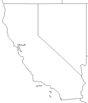
Click for printable map of California
(Browse all the other World Maps.)
Map of California links to other maps
- Barstow topo – (click on the map to enlarge)
- Blythe typo – (click on the map to enlarge)
- Carmel By The Sea topo – (click on the map to enlarge)
- Chico topo – (click on the map to enlarge)
- Death Valley National Park [California / Nevada] (PDF)
- Devils Postpile National Monument (PDF)
- Federal Lands and Indian Reservations (PDF)
- Golden Gate National Recreation Area – Northern (click on the map to enlarge)
- Golden Gate National Recreation Area – Southern (click on the map to enlarge)
- Half Moon Bay topo – (click on the map to enlarge)
- Joshua Tree National Park (PDF)
- Lakeport topo – (click on the map to enlarge)
- Lassen Volcanic National Park (click on the map to enlarge)
- Lincoln topo – (click on the map to enlarge)
- Los Angeles (click on the map to enlarge)
- Monterey topo – (click on the map to enlarge)
- Palm Springs topo – (click on the map to enlarge)
- Pinnacles National Monument (click on the map to enlarge)
- Point Reyes National Seashore (PDF)
- Political, Northern (click on the map to enlarge)
- Political, Southern (Click on the map to enlarge)
- Redwood National Park (click on the map to enlarge)
- Reference (click on the map to enlarge)
- (same as above, but as a PDF)
- Roads – A good overall map in PDF form. Zoom in to see more detail.
- San Francisco (click on the map to enlarge)
- San Diego (click on the map to enlarge)
- Sequoia and Kings Canyon National Park (click on the map to enlarge)
- Whiskeytown National Recreation Area (PDF)
- Yosemite National Park (click on the map to enlarge)
- California Blank Outline Map
- Blank Outline w/State Borders
- Blank Outline Map with Capital
- California Counties Bureau of the Census 1990 (click on the map to enlarge)
- California Counties U.S. Census Bureau Shaded (click on the map to enlarge)
- Color County w/names Map
- Gray Scale County w/names Map
- Land Regions – Black and White Map (PDF)
- Gray National Geographic Cities Map
- Color Landform Map
- Color Landform Map with Counties
- Grey Scale Landform Map
- Major West Coast Volcanoes Map – USGS
- Average Annual Precipitation Map (PDF)
- State Highway System Area Maps (click on the map to enlarge)
- California Population Map 1990 (click on the map to enlarge)
- California Detailed State Map (PDF)
Downloadable
- Blank Outline Map – A printer-friendly document.
- Roads – You can zoom in and print your own maps at a large scale.
For purchase
- California, Northern – A laminated, tear-proof highway map.
- California, Southern – A laminated, tear-proof highway map.
- California State – Paper – A beautiful shaded relief map available in plain paper or laminated.
- For a large selection of other California maps, click here.
California Of Interest

In 1535, explorer Hernando Cortes entered the land we now know as California. Sir Francis Drake claimed the area for England’s Queen Elizabeth after he explored the coast in 1579. Mexico took control of California in 1825, but gave it up again in 1848. It finally became a state in 1850.

San Francisco Bay is the world’s largest landlocked harbor and California has what is considered to be the most fertile valley in the world. It has the oldest known living organism – a 4,600 year old bristlecone pine, and the largest living tree – a California redwood with a trunk 101.6 feet in circumference.
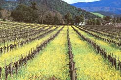
California has a huge productive economy. If it were a nation it would be one of the ten largest economies in the world. Grapes, cotton, flowers, and oranges are the state’s most valuable crops. California leads the nation in the production of vegetables and fruits, including tomatoes, strawberries, carrots, lettuce, broccoli, onions, and almonds. The state produces the greatest share of the nation’s domestic wine. California’s farms are highly productive due to a long growing season, good soil, and the use of modern agricultural methods. Irrigation is key, especially in the Imperial and San Joaquin Valleys. The picking and shipping of crops is done mostly by seasonal migrant workers, primarily Mexicans.
See related information at United States Maps
Browse all the other World Maps.