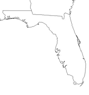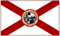
Click for printable map of Florida
(Browse all the other World Maps.)
Map of Florida links to other maps
- Big Cypress National Preserve (click on the map to enlarge)
- Biscayne National Park (click on the map to enlarge)
- Canaveral and Merritt Island National Seashore (click on the map to enlarge)
- Dry Tortugas National Park (click on the map to enlarge)
- Everglades National Park (PDF)
- Federal Lands and Indian Reservations (PDF)
- Historical – A large selection of historical Florida maps.
- Miami (click on the map to enlarge)
- Palmetto (click on the map to enlarge)
- Pensacola Bay (Area Features) (click on the map to enlarge)
- Political (click on the map to enlarge)
- Reference (click on the map to enlarge)
- St. Augustine (click on the map to enlarge)
- Shaded Relief (click on the map to enlarge)
- Northwest Florida (PDF)
- North Central Florida (PDF)
- Northeast Florida (PDF)
- South Florida / Tampa Bay (PDF)
- Southwest and Central Florida (PDF)
- South Florida (PDF)
- Historical State Maps (entire state of Florida)
- Historical Regional Maps (more than one county)
- Historical County Maps (one county only)
- Historical Local Maps (less than one county)
- Congressional Districts
- County Hydrography and Waterways Maps
- County Outline Maps with Cities Labeled and Unlabeled
- County Sinkhole Maps
- County Transportation Maps
- Florida County Locater Maps
- Hurricanes and Tropical Storms
- Native Americans
- Tree Distribution
Downloadable
- Blank Outline Map – A printer-friendly document.
- Roads – You can zoom in and print your own maps at a large scale.
For purchase
- Highway, Free – Fill out the form to order a free map.
- Florida FlexiMap – A laminated, tear-proof folding highway map.
- Florida Satellite Map – A photograph of Florida from 440 miles above Earth.
- Florida Wall Map – A richly-colored shaded relief and elevation tinted map.
- For a large selection of other Florida maps, click here.
Florida Of Interest

The “discovery” of Florida is attributed to Juan Ponce de León in 1513, although others knew of the territory previously. In 1763 the British took control of Cuba from Spain, then traded Cuba back to Spain for Florida. Spain once again acquired Florida until they gave it up to the United States in 1819. It became a state in 1845.
Tourism plays a major role in the state’s economy; visitors spend over $36 billion annually. Walt Disney World, a huge theme park near Orlando; Universal Studios, a combination theme park and film and television production facility; and other features draw millions of tourists every year. Popular beaches, such as those at Daytona Beach, Miami Beach, and Fort Lauderdale, attract very large numbers of vacationers. With over 4,000 square miles of inland water and with the ocean easily accessible from almost any location in the state, Florida is fishing heaven. Other sites are Palm Beach, with its grand estates; Everglades National Park, with its wide variety of plant and animal life; and Sanibel Island’s lovely accomodations.

Florida leads the nation in the production of grapefruits, oranges, tangerines, tomatoes, and corn. Other major crops are sugarcane and many kinds of other vegetables. Commercial fishing (including lobsters, crabs, and shrimp) is an important industry. Cattle and dairy products are also play a large role in the agricultural economy.
See related information at United States Maps
Browse all the other World Maps.